NW Trails: Spring Wildflower Hikes

Head to the foothills for early-season blossoms:
Mount Pisgah, Patterson Mountain, Grassy Top
Story and Photos by Craig Romano
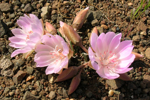
Photo above right: Bitteroots thriving amid the rocks of Patterson Mountain.
It’s looking like it’s going to be yet another hiking season of heavy snow packs in the Cascades. What’s an alpine wildflower-appreciating hiker to do?
NW Trails is sponsored by:
It’s bad enough that during a normal season you have to wait until June or July to be able to savor the sweet fragrances and dazzling displays of flowers along the trail. Does all this snow in the mountains mean you need to wait until August to walk through resplendent wildflower displays?
Not at all.
The foothills are currently alive with the smells and colors of brilliant blossoms. Here are three superb wildflower hikes currently in bloom that deliver outstanding floral shows year after year—no matter how much snow falls in the nearby higher country. Enjoy, and don’t forget to stop often along the way to smell the flowers.
Mount Pisgah
Willamette Valley, Ore.
Roundtrip: 3 miles
Elevation Gain: 1,050 feet
Fees/Restrictions: $3 day-use fee; dogs must be leashed
Kid-friendly, dog-friendly
Rising above the confluence of the Middle Fork, and Coast Fork, Willamette Rivers, just minutes from downtown Springfield and Eugene, Ore. is 1,531-foot Mount Pisgah. The centerpiece of the 2,363-acre Howard Buford County Park, hikers can choose from more than 16 miles of excellent trails across this beautiful and ecologically diverse landscape.
The views alone of the Willamette Valley and the foothills of Oregon’s Central Cascades are enough of a draw to this peak named by early settlers for the mountain in which Moses first saw the Promised Land. However, there’s more reason to hike Pisgah’s verdant slopes.
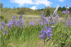
In springtime, the mountain’s oak savannah bursts into a kaleidoscope of flowers. No hike boasts better and bigger camas flower displays than this gorgeous mountain hike overlooking Oregon’s heartland.
There are several ways to get to Pisgah’s summit and you can easily spend all day—or two—hiking within this park. There’s a good map available online (see resource box) — print it and take it. Take trail number one, an old service road now a wide and smooth trail 1.5 miles to the open summit. Soak up the views and then explore at will the flowering radiating slopes.
Aside from camas flowers, look for Oregon iris, western buttercups, shooting stars, fawn lilies and plenty of other species.
Patterson Mountain
Methow Valley, Wash.
Roundtrip: 3.7 miles
Elevation Gain: 1,100 feet
Fees/Restrictions: Discover Pass Required
Green Trails Map: Sun Mountain, WA- No.83S
Kid-friendly, dog-friendly
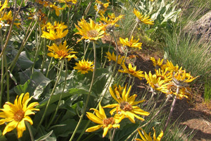
Patterned with lupine and larkspur, bitterroot, buckwheat and balsamroot, Patterson Mountain is packed with showy blossoms in April. Wedged between the Methow River and the old Western town of Winthrop’s famous Sun Mountain Lodge, this 3,500-foot mountain in north central Washington melts out early, offering excellent springtime wanderings.
While the floral show is the main draw to this hike, don’t discount the views. From the sparkling waters of Patterson Lake to the glistening glaciers of the Sawtooth Ridge, Patterson provides panoramic pleasure.
The hike begins directly across from Patterson Lake’s boat launch. Immediately begin climbing the sun-baked slopes. The trail is in excellent shape, part of an extensive system developed and maintained by the Methow Valley Sports Trail Association. After .3 mile, reach a four-way junction. The trail left leads .7 mile to an alternative trailhead near Patterson Lake’s dam. Take the path right. You’ll be returning on the path straight ahead.
Steadily ascending, traverse grassy slopes punctuated with groves of aspen. Admire Patterson Lake shimmering below. After passing a lone ponderosa pine come to a junction. The loop continues straight, but, first a mandatory side trip to Patterson’s 3,500-foot summit is in order.
Follow the spur right for a half mile to the broad and wide open summit. Views! Savor them, from the snowy and serrated Sawtooth Mountains to the golden foothills embracing Winthrop. Don’t forget to occasionally look at the ground to marvel in the boundless blossoms surrounding your boots.
Grassy Top
Columbia River Gorge, Wash.
Roundtrip Loop: 4.4 miles
Elevation Gain: 1,050 feet
Green Trails Maps: Wind River No. 397, Willard No. 398
Dog friendly, Kid-friendly
While Dog Mountain may be the Columbia River Gorge’s premier wildflower hike, Grassy Top is a pretty darn close second best. Better yet, this 3,648-foot peak just north of Dog Mountain entertains a fraction of the crowds that rove up and down that well-hiked summit.
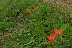
Shrouded in a kaleidoscope of showy wildflowers, this former lookout site also offers jaw-slacking volcanic views of Mounts Hood and Adams. A rocky, craggy knoll along the way grants an eagle’s eye perspective of the massive, and appropriately named, Big Lava Bed—a 9,000 year old, 20-square mile flow of basalt. Flowers start immediately on this hike as the trail leads up an open ridge adorned with larkspur, paintbrush, desert parsley and more. Then it’s a stint through beautiful old growth, before emerging on a rocky knoll providing exceptional viewing over the sprawling Big Lava Bed with Mount Adams hovering above.
Continue on the trail descending a bit before steeply climbing to the broad, appropriately-named 3,650-foot Grassy Knoll. All that remains of the lookout are the foundation posts. However, a tower isn’t necessary to take in the stupendous views from this outpost.
Gaze south to hulking Augspurger Mountain, conical Wind Mountain, icy Mount Hood, and the shimmering Columbia River. Stare east to Silver Star and northeast to Mount Adams. Don’t forget to cast your eyes downward to a myriad of flowers, including daffodils that were no doubt planted years ago by a fire keep.
Craig Romano is Trails Editor of Outdoors NW and the author of eight Northwest hiking guidebooks including Day Hiking Columbia River Gorge (The Mountaineers Books). Visit him at http://CraigRomano.com
Trailhead Directions
Mount Pisgah: From Exit 189 on I-5, head to Franklin Boulevard. Follow for .4 mile turning left onto the Seavey Way Loop. Continue for 1.5 miles turning right into Buford County Park. Then proceed .4 mile passing the entrance station to parking and trailhead.
Patterson Mountain: From Winthrop head east on SR 20 for .6 mile turning right onto Twin Lakes Road just after crossing the Methow River. Follow for 3 miles, turning right onto Patterson Lake Road. Continue for 4 more miles to boat ramp and trailhead.
Grassy Top: From Stevenson, head east on SR 14 for 3 miles, turning left onto the Wind River Road. Then proceed 4.1 miles turning right (just after Wind River Bridge) onto Bear Creek Road. Follow this road, which becomes FR 6808, after 3.6 miles and continue for another 7.1 miles to an unsigned junction. Turn left onto FR 68, reaching a junction and trailhead at 2.1 miles at Triangle Pass.
Resources
Mount Pisgah: www.bufordpark.org
Patterson Mountain: http://www.dnr.wa.gov
Grassy Top: www.fs.fed.us/gpnf


