NW Trails: Mt. Erie

Highpoint of the Anacortes Community Forest Lands
Story and Photos by Craig Romano
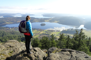
Photo at right: View from Mt. Erie summit looking south.
Gateway to the San Juan Islands, the small city of Anacortes harbors quite a bit of maritime magic of its own. Once a logging and cannery town, Anacortes has been attracting retirees and urban refuges for some time now. Industry and fishing are still an integral part of the town’s identity—but so, too, is recreation now.
NW Trails is sponsored by:
The city contains over 3,000 acres of green spaces including one of the largest municipal-owned forests in the region, the Anacortes Community Forest Lands (ACFL).
Managed by the city’s Parks and Recreation Department and an advisory board, the ACFL contains over 2,800 acres of forest, wetlands, lakes and a handful of small peaks. Originally consisting of parcels once used to protect the city’s water supply, the ACFL has increased in size over the years through purchases and generous donations. The Skagit Land Trust owns the conservation rights on much of the ACFL assuring that this ecological and recreational gem with its 50-plus miles of trails remains in a natural state.
Yes, I did say 50-plus miles of trails. Beloved by hikers, mountain bikers and trail runners, the ACFL contains an amazing network of well-marked and well-cared-for trails that are easily accessible to recreationists of all ages and abilities. While they’re open and popular year-round, late fall and winter are excellent times to visit as Anacortes sits within the Olympic rain-shadow. It’s not uncommon to be out on a hike here while snows and heavy rains hammer trails south and west of the forest.
You can spend countless days exploring the trails and quiet corners of this sprawling green space. And while the ACFL’s numerous lakes make for great kid- and dog-friendly wandering, a trip up the forest’s 1,273-foot highpoint, Mt. Erie, is in order.
While Erie is accessible by a paved road, it still makes a fine hike, especially during weekdays and on the rare occasion that snow closes the road.
Reaching the open summit
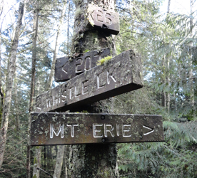
There are a couple of ways to reach the rocky open summit of Mt. Erie, and climbers who come here in droves know the most direct routes. But for a fairly quiet walk in the woods to this summit, start at the trailhead at the summit road’s base. Follow Trail No. 215 for a short distance before veering left onto Trail No. 320.
Traverse beautiful old-growth forest and come to Trail No. 21. Now follow this old fire road on a steady ascent to Trail No. 230. Then pass through a low gap and descend to a junction in a ravine above a bubbling creek.
Now head right onto Trail No. 207 and follow switchbacks upward to yet another junction. Take Trail No. 216 left and wind your way up Fidalgo Island’s highest summit. The way is rough in sections, having you hobble over roots and scamper up ledges at times. It’ll make you appreciate this summit so much more than someone who merely drove to it.
At just over two miles, the trail brushes up along the summit road before making its final pitch over ledge and through thick forest. Reach the road at the summit at 2.5 miles and head for the various viewpoints.
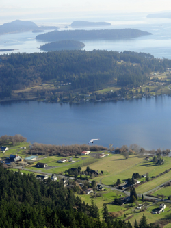
The view east overlooking March Point and Fidalgo Bay is being overtaken by vegetation. Spend your time instead at the busy overlooks south near the communications towers. Find a quiet nook if you can and savor the scenery. The view is excellent over Whidbey Island out to Glacier Peak, Three Fingers and Mount Rainier. There are great views, too, of Skagit Bay with Kikit, Skagit and Hope islands; and of Campbell Lake directly below the mountain’s north face. The lake’s little island happens to be the largest island on a lake on an island in Washington state.
Peregrine falcons nest in the cliffs below. Rock climbers can often be seen clambering up those same formidable cliffs. Big birds thundering from the Whidbey Island Naval Air Station can often be observed from here, too. Sunsets are grand. Walk the road back down if you stay that late as it makes an easier decent in the fading daylight.
Getting you on your way
Trip Details
Distance: 5.2 miles roundtrip with 900 feet of vertical elevation
Trailhead Directions: From Burlington, head west on SR 20 to Fidalgo Island turning right onto Campbell Lake Road. After 1.5 miles bear right onto Heart Lake Road and continue for 1.5 miles to trailhead at right near Mt. Erie Road.
Green Trails Maps: Deception Pass Anacortes Community Forest Lands No. 41S
Notes: Dogs permitted on leash.
Contacts: Anacortes Parks and Recreation; (360) 293-1918
www.cityofanacortes.org/parks/ForestLands
Craig Romano is Trails Editor of OutdoorsNW and is the author of nine Northwest hiking guidebooks including the Winter Hikes of Western Washington deck (The Mountaineers Books), which spotlights 50 snow-free hikes. Visit him at www.CraigRomano.com.


