NW Trails: Lake Lacrosse
Backpack deep into the heart of the Olympic Peninsula
Story and Photos by Craig Romano
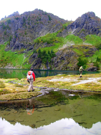
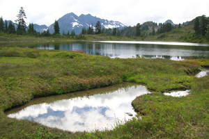
Photo at right: Lake LaCrosse in the heart of the Olympics
Sparkling Lake LaCrosse lies in a flower-saturated meadow surrounded by jagged snow-streaked Olympic National Park peaks that catch processions of moisture-laden clouds rolling in from the Pacific.
NW Trails is sponsored by:
Far from roads and settlements, the LaCrosse basin is an untrammeled place of striking natural beauty, hosting more bears and elk than it does backpackers.
There are several ways to reach this spot deep with the Olympic Mountains wilderness. None of them are short or easy, making LaCrosse and its surrounding lakes and ridges an all-the-more attractive destination for solitude-seekers and wilderness worshippers.
In many ways, Lake LaCrosse represents the very essence of Olympic National Park as one of the wildest spots remaining in the country.
Out of the several ways to get to Lake LaCrosse, I prefer the approach from Staircase which follows the historic O’Neil route across the Olympics.
In 1890, one year after the famous Press Trip traversed the Olympic Interior from north to south, Lieutenant Joseph P. O’Neil led a group of scientists and soldiers across the Olympics from east to west. Among the party’s many findings was O’Neil’s realization that the Olympic interior would serve admirably as a national park.
After visiting the area himself, President Theodore Roosevelt established an Olympic National Monument in 1909. In 1938, it became a national park under President Franklin D. Roosevelt.
Getting started
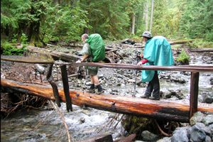
The Staircase approach starts off fairly gentle, following the North Fork Skokomish Trail, which utilizes an on old road bed. Head upriver, crossing scores of tumbling side creeks. There is no lack of water on this route. At just shy of four miles, reach popular Spike Camp—it’s a good place to set up if you got a late start.
Now the trail gains a little elevation through some impressive old-growth. Cross Madeline and Donahue Creeks in dank ravines before coming to Big Log Camp along the North Fork Skokomish. Continue straight crossing the North Fork Skokomish on a good bridge above an impressive chasm, then continue hiking along the river through maple glades reaching riverside Camp Pleasant. It really is a pleasant spot to bed down for the evening.
Continue easy walking along the river and through gorgeous old-growth arriving at Nine Stream Camp at just over nine miles. Up to this point the hiking has been easy. But from here on the mood changes—the trail now climbs steeply and with a purpose.
Through beautiful groves of ancient timber, no time is wasted gaining elevation. At just over 11 miles, come to Two Bear Camp in a berry patch by the creek. Expect to see more than two bruins in the meadows and huckleberry patches that follow. On my last trip here I tallied 14 of those little brown bears, including one that enjoyed hanging around my campsite.
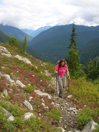
The trail continues to climb, crossing pocket meadows with growing views down the North Fork. Skirt around a pretty little tarn before cresting 4,700-foot First Divide, then steeply descend into the sprawling meadows of 4,200-foot Home Sweet Home at 13.5 miles. Find excellent camps here set among flowering meadows beneath a cascade tumbling down from 6,114-foot Mount Hopper. Views are excellent across the green carpet to 6,223-foot Mount Steel.
Now follow the Home Sweet Home Trail, rapidly losing elevation through a majestic forest of ancient yellow cedars, hemlocks, silver fir and Douglas fir. You’ll come to the Duckabush Trail. Upper Duckabush Camp is located in big timber along the crashing Duckabush River just to the right.
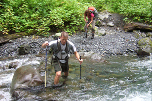
For Lake LaCrosse, head left immediately, fording Home Sweet Home Creek, which can be tricky.
The way now turns rough, traversing brushy avalanche chutes and crossing snow-melt creeks cascading from steep imposing cliffs. After a short stiff climb, the trail skirts a steep slope high above the river churning through a tight canyon. The trail eventually approaches the crashing Duckabush River where it must be forded. It’s usually knee deep—but in early season and during rainy periods, it’s much deeper and dangerous.
Once across the Duckabush, the trail crosses yet another crashing creek—then swiftly climbs out of the valley, reaching a high bench cradling shallow Marmot Lake (elev. 4,375 feet). Here at 19 miles from your start, find good camps and a junction. The trail left leads 1.2 miles to 5,400-foot O’Neil Pass, a good side trip after setting up camp.
Getting to the lake
For Lake LaCrosse, take the trail right, climbing .6 mile to an open 4,900-foot knoll. Spectacular views can be had east down the Duckabush River Valley, south to Mount Steel and Mount Duckabush’s snowy slopes, and north to sparkling Lake LaCrosse and its enveloping verdant meadows (often snow-blotched until August). A short side-trail here wraps around a rocky outcropping to gorgeous Hart Lake with its excellent private camps and breathtaking views of Mount Duckabush.
The main trail continues another .9 mile across shimmering creeks, flower-bursting meadows and jaw-slacking alpine scenery to Lake LaCrosse (elev. 4,700 feet). It’s surrounded by steep slopes rife with succulent grasses and berries coveted by bear, elk, and marmots—all abundant here in one of the most wild and untrammeled places within the Olympics.
Getting you on your way
Trip Details
Distance: 41 miles roundtrip with over 8,000 feet of vertical elevation
Trailhead Directions: From Olympia travel north on US 101 to Hoodsport. Turn left onto SR 119, proceeding 9.3 miles to a T-intersection with FR 24. Turn left continuing on SR 119 for 1.7 miles. Now follow gravel road for 3.7 miles. Bear right reaching the Staircase Ranger Station and trailhead in 1.2 miles.
Permits Required: National Park entry fee; Olympic National Park Wilderness Camping Permits attainable at Staircase Ranger Station
Green Trails Maps: Mount Steel No. 167
Notes: Dogs prohibited
Contacts: Olympic National Park Wilderness Information Center; www.nps.gov/olym
Craig Romano is Trails Editor of Outdoors NW and is the author of nine Northwest hiking guidebooks including Backpacking Washington (The Mountaineers Books), which includes detailed trail information on this route. Visit him at CraigRomano.com.


