Ride from Seattle to Snoqualmie on one trail

By Kris Parfitt
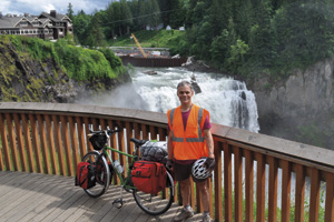
Photo at right: King County Parks and 4Culture artist-in-residence, Brian Borrello, stops at Snoqualmie Falls while on a 100-mi/four-day trip photo-documenting the Regional Trails System experience. Photo courtesy of Brian Borrello, www.brianborrello.com
As part of a scenic 50-mile journey, cyclists can now ride from Seattle to Snoqualmie Falls along part of King County’s 175-mile Regional Trails System. The newest link connected Issaquah and Preston late last summer, thanks to the Mountains to Sound Greenway.
This means cyclists can hop on the Burke-Gilman Trail in Seattle and ride connected trails via the 11-mile Sammamish River Trail starting in Bothell, the 1.6-mile Marymoor (Park) Connector Trail, the 11-mile East Lake Sammamish Trail, the seven-mile Issaquah-Preston Trail and finally to the existing seven-mile Preston-Snoqualmie Trail.
“The Mountains to Sound Greenway encompasses a world-class regional trail system,” says Cynthia Welti, Executive Director of the Mountains to Sound Greenway Trust. “Our vision is that a walker or bicyclist could travel on safe, enjoyable, off-road routes that connect Puget Sound urban areas to the Cascades and central Washington.”
The Mountains to Sound Greenway is the 1.5 million-acre landscape connecting Puget Sound and central Washington.
Resources:
King Country Regional Trails System: www.kingcounty.gov/recreation/parks/trails/regionaltrailssystem.aspx
Mountains to Sound Greenway: www.mtsgreenway.org
King County Parks and 4Culture Art Program: http://bit.ly/1EMaYLU
If you like this post, you might also enjoy:
Buzz Cycling Features Home Recent Articles The OutdoorsNW Blog


Matt, 1 month ago
This is incorrect. The Preston-Snoqualmie trail is a dead end on the Snoqualmie side. The view of the falls is distant and at the mercy of the tree foliage. If this trail went another mile and connected with Snoqualmie Parkway it would be a useful way to get to the falls.
The photo in the article is from the overlook that is at the falls.
There is not a way to get to Snoqualmie Falls, Snoqualmie or North Bend from any city via bike trails with exception of Duvall, Carnation and Fall City. You must ride on highways at some point.
kris, 1 month ago
Thank you Matt for pointing this out. We contacted the Mountains to Sound Greenway Trust about your comment and the Coalition Director, Amy Brockhaus, provided more information about the Gap Map that helps riders link the Regional Trails System trails where there are gaps. Here is her response:
“Your writer is correct, there are some missing links in the trail system in and near Snoqualmie. We publish the “Regional Trails Gap Map” available at http://mtsgreenway.org/about/maps. That shows missing links and what is being done to connect existing trails.
For riders, the most efficient route finding is found at King County,
http://www.kingcounty.gov/…/Maps/VMC/Recreation.aspx...
The Snoqualmie Valley Trail does run from Rattlesnake Lake, north through North Bend, through Snoqualmie but with some missing links, and then on to Carnation. The City of Snoqualmie is currently planning a new trail to connect from the Falls to the historic downtown, but that is not in place yet.”